How To Predict The Weather With Clouds
Clouds have been man’s best friend since he woke up in Africa, well, perhaps not his best friend, but they’ve always been around. Humans throughout history have paid attention to them in an effort to be forewarned about what weather conditions might lay ahead.
As time has gone on and people have got cleverer with technology and more engrossed in Candy Crush, we’ve let people like Michael Fish worry about the ins and outs of the weather and we wait with baited breath for the experts to tell us what will happen in the skies next. It’s time to take the power back.
The neglected cloud has continued unabated and unwatched for decades but only recently has it come back in to favour, albeit for the wrong reasons. Nowadays if someone looks at a cloud that seems “weird” they scream “chemtrail!” And thanks to the birth of camera phones, any weird looking cloud can be documented and shared instantly. All of a sudden people are looking at the sky again, and drawing their own conclusions.
You can’t decide a cloud looks “odd” if you don’t know anything about normal clouds. You can’t assume a cloud is laden with brainwashing chemicals because it’s a strange colour if you’ve never paid any attention to what colour clouds normally are.
So I thought I’d attempt to redress the balance and have a bit of a look at our wizened and watery friends in a bit more detail. But before we start predicting the weather with clouds… what are they?
What Is A Cloud?

Yes, I know it’s a bit pre-GCSE but there’s nothing like a nice recap to get you started. And, on top of that, loads of people think clouds are made of cotton wool and/or anthrax so it’s probably worth a second look.
Clouds are suspended droplets of water vapour and/or ice crystals depending on how high up they are. In a cubic metre of cumulus cloud (the big fluffy ones) there’s about a marble’s worth of water; each cumulus is an average of 1 km long. That means that an average cumulus cloud weighs about as much as 100 elephants. All of that just floating above your head.
Clouds form due to the atmosphere becoming saturated, and that can be for one of two reasons:
a) Cooling of the air – cool air can’t hold as much water as warm air, so as it gets colder the water that it’s holding onto condenses out and forms clouds.
b) Adding water vapour – if more water enters the atmosphere, e.g. from a large body of water being warmed up by the sun and evaporating, clouds will form.
So here are some ways that you can predict or guess what might be about to happen weather-wise. These aren’t exact rules as Michael Fish will tell you, but at least it gives you an idea and a sense of what these gentle behemoths are up to…
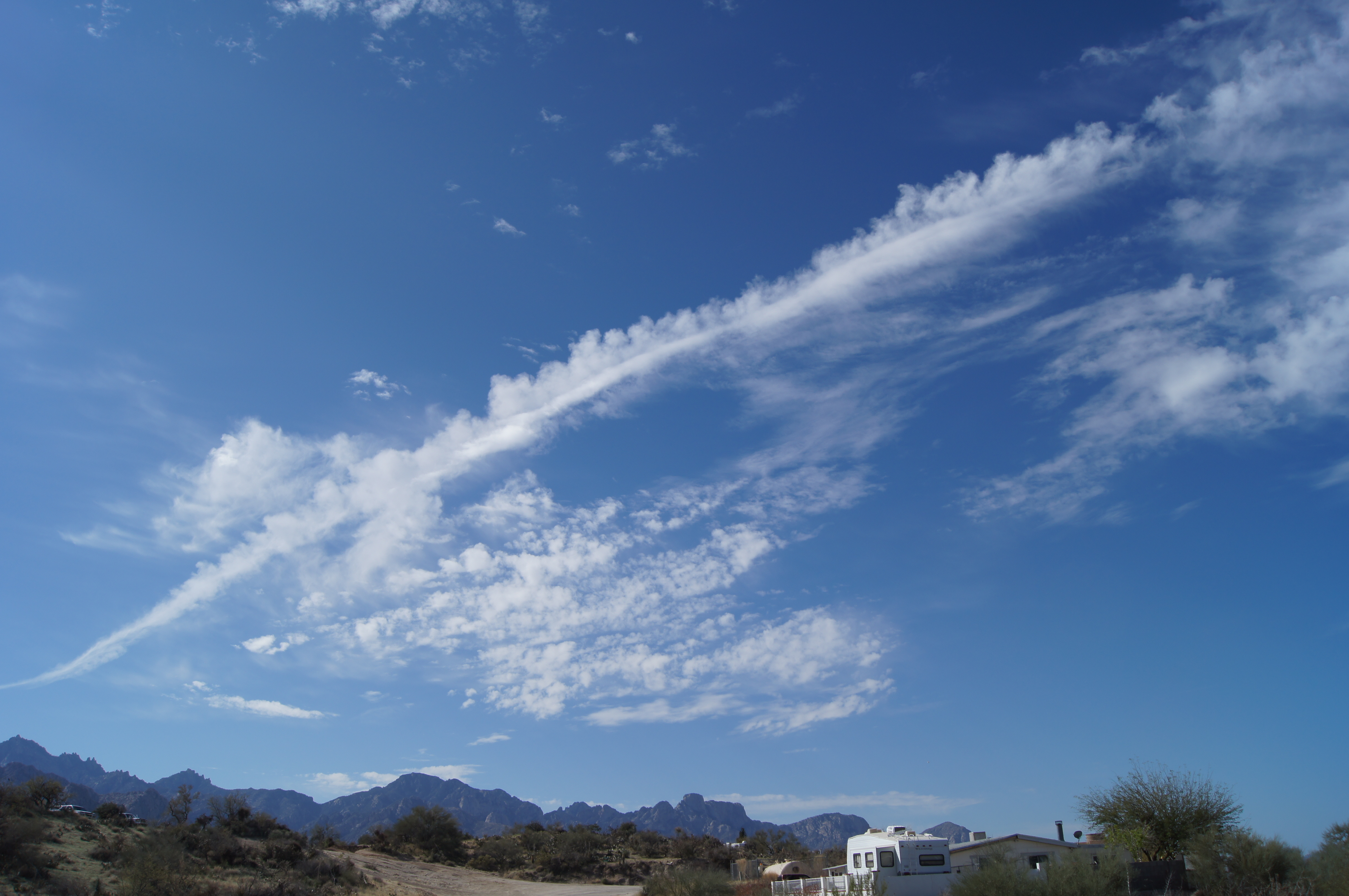
1) Cirrus Clouds

Cirrus are the long feathery ones you see that live high in the atmosphere, they’re made mostly of ice crystals. The name comes from the Latin word cirrus meaning ringlet of hair. They sit at around 5000-6000 m up and if they’re in the jet stream they can stretch the length of a continent.
If you see just a few of these stringy “mare’s tails” in the sky it means you’ll probably have a warm spell. However, if you start to see them increase in number and steadily get lower and thicker, you’re in for some rain.
If they form like this next photo, with bumps on top of the tendrils it’s called cirrus castellanus. This means there is instability in the upper atmosphere and there may be stormy trouble ahead.
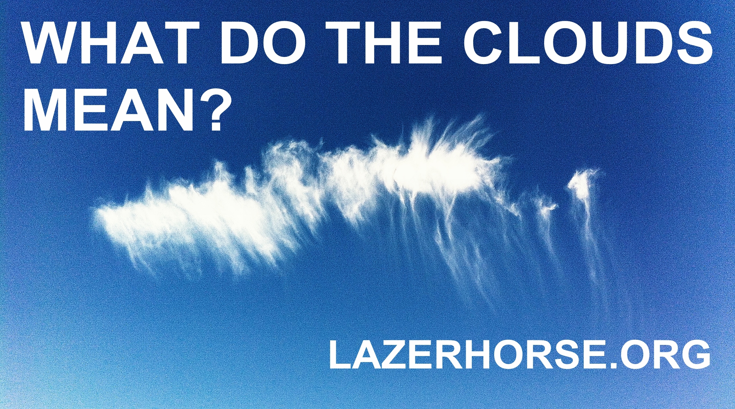
And if they look like this:
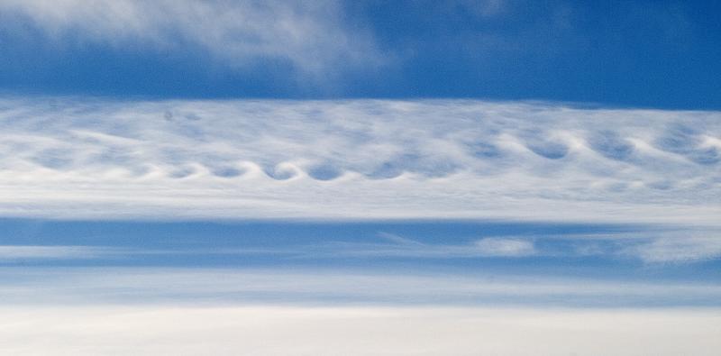
… they’re called Kelvin-Helmholtz waves and that means that there’s a high level of wind shear up there, i.e. wind moving in different directions.
2) Cirrocumulus

Cirrocumulus are also high level clouds, they normally show up at between 5 and 12 km up. Unlike most high level clouds they do contain a bit of liquid water alongside the ice. But this water is in a supercooled state. Cirrocumulus are sometimes referred to as “mackerel clouds” because of their similarity to the skin of mackerel(?):
Cirrocumulus are more blotchy than standard cirrus. If you’re watching a patch of it amongst cirrus clouds, you may see it start to grow in size and steadily take over the cirrus clouds. If cirrocumulus do expand in number this often means rain will follow in the next 8-10 hours.
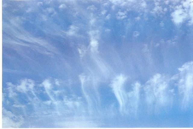
If you see “virga” pictured below, that’s also a good predictor that a rainy front is on its way. Virga are essentially shafts of rain that evaporate before they reach the ground. Despite the rumours they’re nothing new and nothing to do with HAARP at all.
But, if the small patch of cirrocumulus doesn’t grow, you’ll probably be OK and you can relax and enjoy the sun.