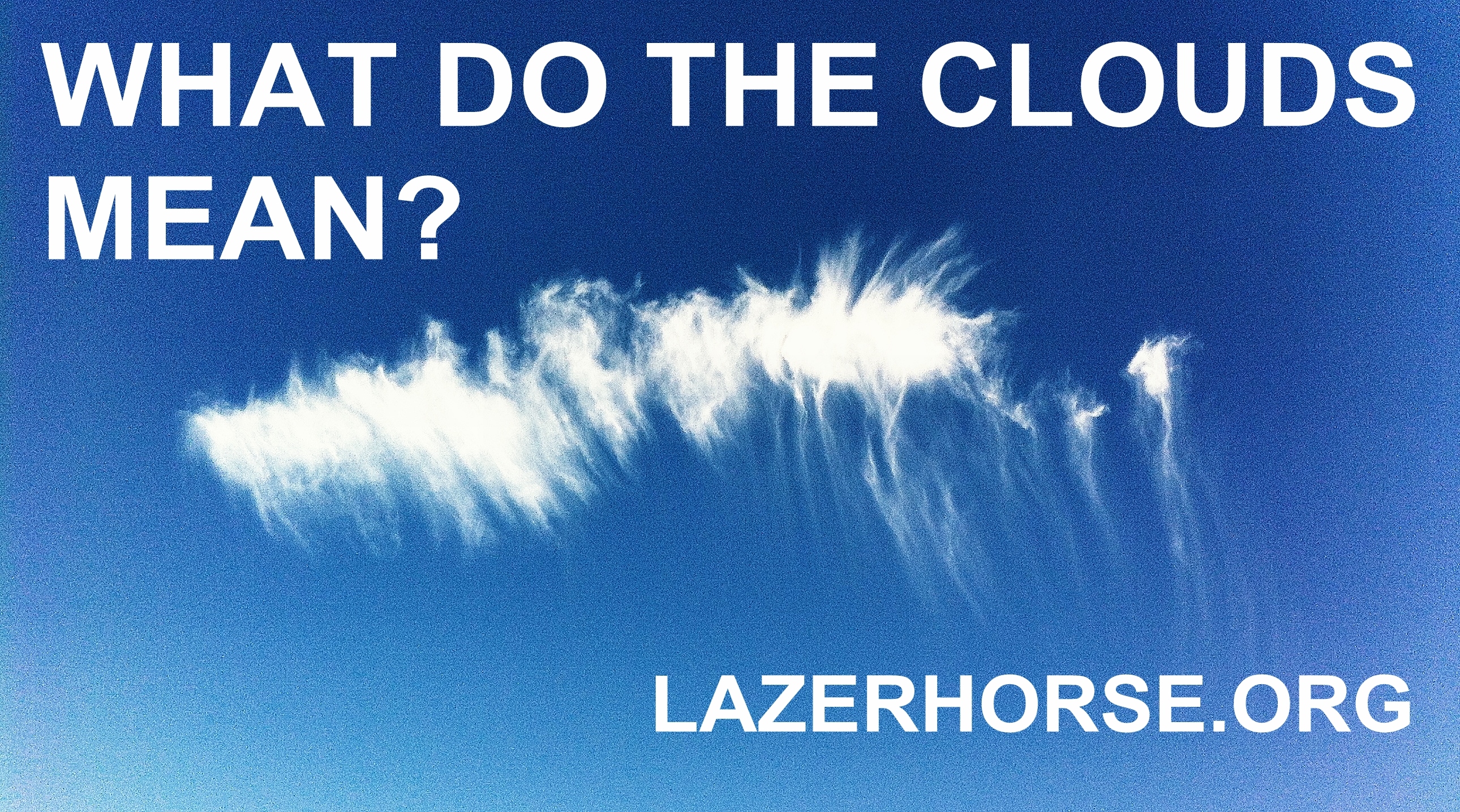
How To Predict The Weather With Clouds
3) Cirrostratus
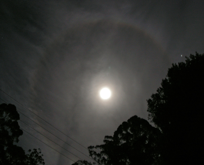
Cirrostratus is a high level sheet of cloud that looks pretty boring. They’re thin and made of ice crystals. As above, you might notice “halos” around the sun (or moon) as the light shines through. The shape and colour of the halos are dependent on what shape the individual ice crystals are within the clouds. They’ve been used for centuries as a warning that rain may well be on its way:
If this sheet of cirrostratus has formed from stringy cirrus, i.e. the strands have all spread out into a sheet, this probably means rain is coming in the next 12-24 hours (or sooner if it’s fast-moving up there).
Contrails from aircraft – the newest type of cloud in the atmosphere – can sometimes spread out to form these clouds. You may also notice other clouds hanging in the air lower than the sheet of cirrostratus becoming flattened. This is because the ubiquitous sheet of cloud keeps things constant and stops air from rising and falling willy-nilly.
4) Altocumulus
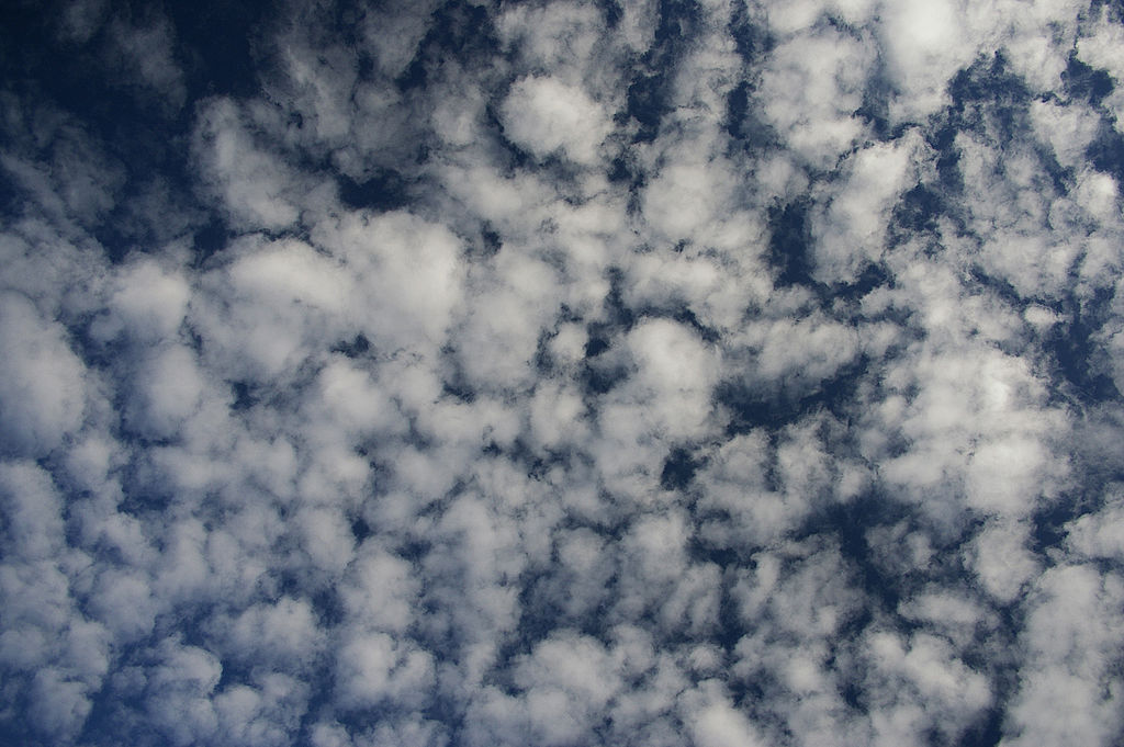
These are mid-level clouds (2000-6000 m) and appear as medium-sized fluff balls. They are generally made up of water droplets rather than ice. If you see these altocumulus start to grow taller into altocumulus castellanus you might be in for some thunderstorms later in the day. This growth of the cloud shows that there is convection in the middle of the atmosphere i.e. air being moved about and changing temperature as it rises and falls.
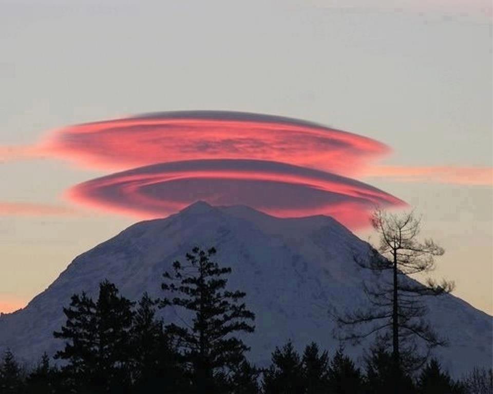
Another type of altocumulus cloud to note is the lenticular cloud. This type of cloud generally forms over mountain tops and looks like a disc. No, it’s not a UFO. Air rushes towards a mountain and is forced up the side, as it rises it cools and can no longer hold as much water so it is released into the atmosphere as a cloud. As the air passes over the tip of the mountain and sinks back down the other side it warms back up and stops producing the cloud.
These clouds are often referred to as standing lenticular because they remain in the exact same spot, unlike other clouds. But they are not truly static, air is still constantly moving up and over the mountain, it’s just that the water is only released from the air (and therefore visible as a cloud) as it cools near the top.
5) Cumulus
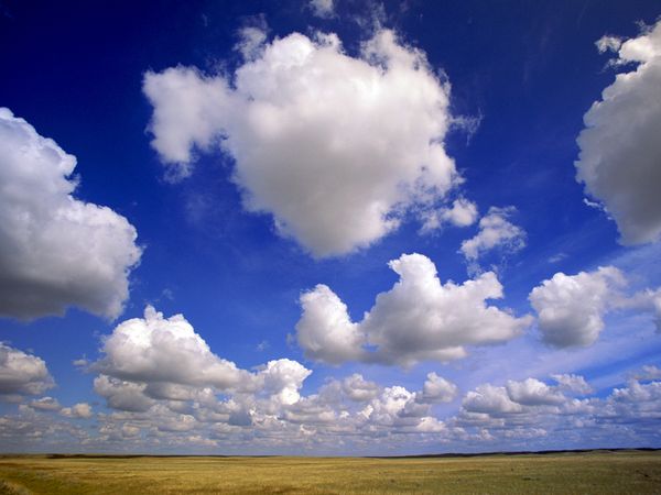
Cumulus clouds are low-level clouds (about 2000 m) and they’re probably the cloud that most people would bring to mind of if you asked them to imagine a cloud. Cumulo means ‘heap’ or ‘pile’ in Latin. They’re generally taken as a sign of good weather, but you still need to watch them, they’re crafty…
6) Cumulonimbus
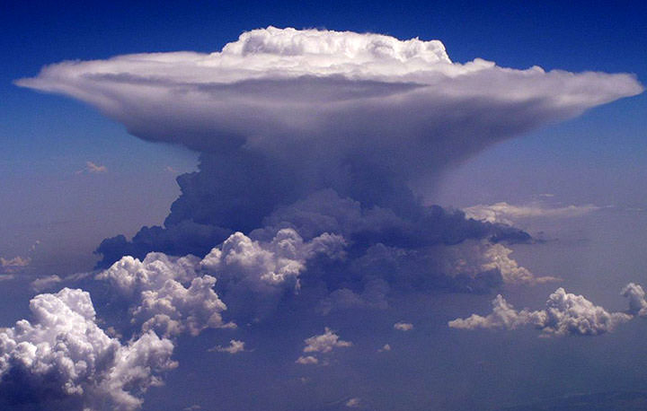
If cumulus start rising up into the atmosphere and turning into cumulonimbus you’re in for thunder and/or hail. Or at least a downpour. Cumulonimbus clouds grow upwards as warm moist air is sucked up inside of them. As the warm moist air zips upwards it cools and condenses into clouds up to 20 km in height. As the water collects high in the atmosphere it forms droplets and nuggets of ice, these then bump into each other and form bigger masses. Once the mass of a droplet is enough to overcome the strength of the warm updraft, they begin to fall. This downfall causes the winds associated with storms.
If the updraft in the cloud is strong enough these particles aren’t released down to earth for longer periods, this means that they’re given the chance to bump into more and more ice crystals and become fairly large chunks of ice. Normally the ice melts as it falls and we experience rain, but if the ice balls created are big enough they don’t have time to melt on their way down to the ground and we get hail. The stronger the updraft in the cumulonimbus, the bigger the hail stones.
The impressive looking “cap” or “anvil” on the top of a storm cloud is formed when the warm air rises until it hits an area of warmer air and can therefore climb no more. This warmer air is generally the tropopause (the area between the troposphere – our normal atmosphere – and the stratosphere). The air can’t rise any higher so it just spreads out.
7) Stratus
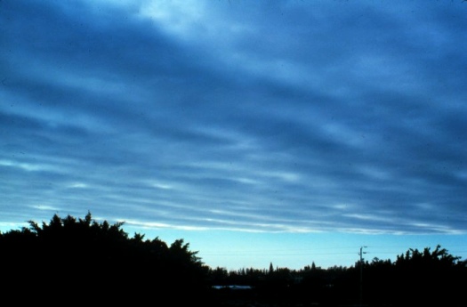
These boring low-level sheets generally mean that there’s not a lot going on, maybe some drizzle. You can relax, but you can’t sunbathe.
Fog is stratus at ground level and is formed by a temperature inversion: instead of air higher up being colder it’s the other way round and there’s a pocket of cold air below a pocket of warm air.
What’s the difference between fog and mist? It’s just a case of visibility. If you can see less than 1 km then it’s fog, if you can see further, then it’s mist.
There’s plenty more to telling the weather from clouds, and as I said it’s not an exact science. But the more you take note of the clouds around you, the more likely you are to guess what’s going on.
Eyes to the skies people.